ATMOS Marlyn
Re-defining Aerial Surveying with ATMOS Marlyn

Plan with Precision
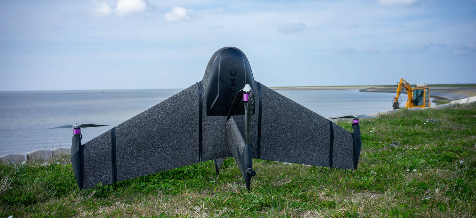
Marlyn is the UAV for those who need total control. The wingtip mounted propellers and large tail-fin give Marlyn stability in survey/airplane mode, while constantly correcting attitude to get sharp aerial images in the toughest of winds.
To handle rough conditions, Marlyn has been engineered to operate in winds of up to 12.5m/s (45km/h), which can result in up to 30% more surveying days each month!
Reduce Time and Cost with PPK
With your integrated Septentrio PPK, you can quickly survey areas down to accuracies as low as 1cm without the time-consuming placing and use of Ground Control Points, and without the need for a constant data link between the aircraft and the ground.
How is ATMOS Marlyn Helping Surveyors?
Increased Efficiency
Marlyn speeds up your data capture by surveying large areas up to 30x faster than traditional land surveying methods, and up to 1Ox faster than Multicopter drones.
Survey Anywhere
Marlyn only needs a 2 x 2m flat area to take off and land, allowing you to be flexible in your operations. Easy backpack transport is also perfect for those heading off the beaten track.
Survey Anytime
With Marlyn you get the benefit of flying in wind conditions of up to 45km/h at ground level, and 55km/h at cruise altitude resulting in up to 30% more days per month.
Absolute Accuracy
Attain accuracies as low as 1cm with Sony’s 42MP, full-frame RX1RII combined with Septentrio’s PPK module, an Aerial surveying match made in heaven!
A Quick Peek Inside Atmos Marlyn
1. Atmos Autopilot
No stress, with our integrated Auto Pilot your flight is automated from take-off to landing.
2. Smart Battery System
Marlyn’s redundancy system gives you peace of mind: one battery functions as a failsafe for the other and can bring Marlyn home if necessary. Handy indicator lights also provide a readout of the current State of Charge.
3. Quick Swap Payloads
In the field you can switch sensors in a minute. With Marlyn’s quick swap camera system you’re ready for any project!
4. PPK
With an integrated high-end GNSS receiver, our PPK module gives Marlyn absolute X, Y, Z accuracy down to 1cm.

ATMOS Marlyn
Applications
Construction & Infrastructure
Marlyn changes the game for land surveyors delivering operational efficiency, reduced downtime, and increased safety. With the PPK; accuracies down to 1cm [0.4in] are easily achieved with fewer to no ground control points.
Surveying & GIS
Compared to terrestrial survey methods, a drone survey yields a point cloud of millions of cm-accurate data points over a 150Ha area, giving you complete data coverage and a massive efficiency boost.
Mining & Aggregates
Marlyn eliminates the need for surveyors to move around the pit, minimising downtime and improving safety. Large, accurate data sets can be created efficiently, at reduced costs with less man hours.
Environmental Protection
Marlyn is capable of seeing beyond the visual, providing new insights into plant health, animal behaviour and more, that was previously thought impossible. This allows you to glean a variety of data to both monitor and provide corrective actions to your study area.
Precision Agriculture
Marlyn‘s multispectral cameras give you the ability to record crop health for larger terrains. Light reflectance in the visible and invisible spectra are used to determine plant stress on an individual level.


Advanced Software You Can Trust
No mapping drone is complete without a professional software package. With Marlyn, you get the best in the business.

Navigator
Navigator is your one stop shop for flight planning, pre-flight checklists, and flight operation, and is designed to be used without any live connection in the field, meaning you can venture into any survey environment with ease!
GeoTagger
Wave goodbye to long workflows, multiple sets of software, and complicated debugging. Assigning accurate positions to your flight images is easier than ever with GeoTagger. You simply select the folders from your different data streams, choose a processing type, and press Geotag!